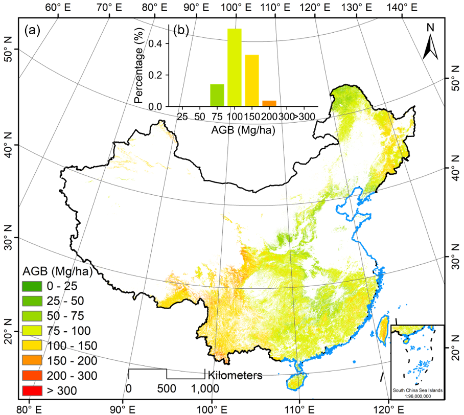
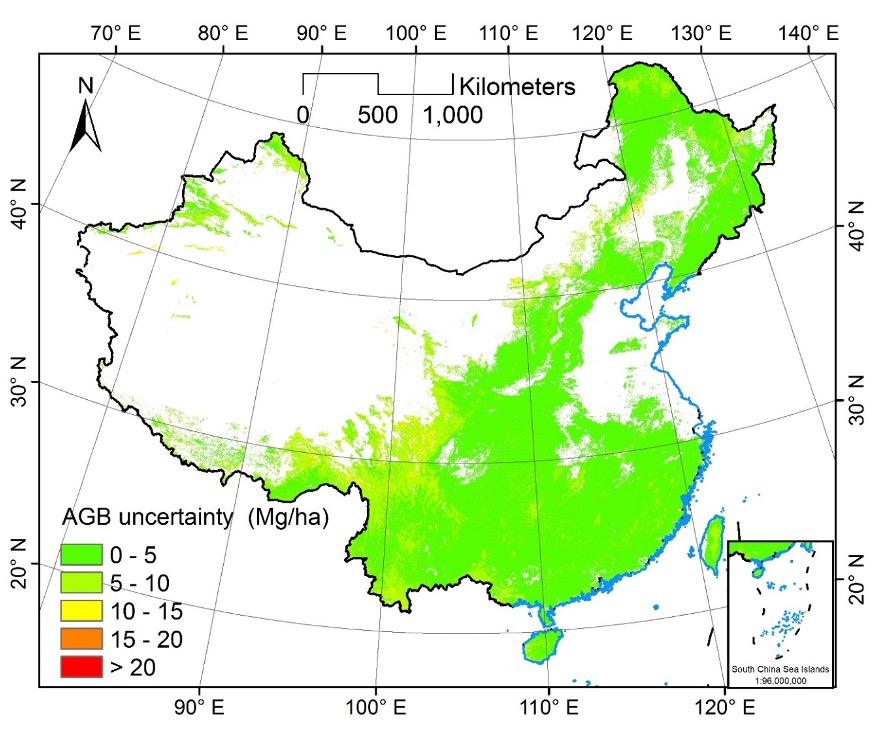
Forest aboveground biomass (AGB) estimation is crucial for carbon cycle studies and climate change mitigation actions. However, because of limitations in timely and reliable forestry surveys and high-resolution remote sensing data, producing a fine resolution and spatial continuous forest AGB map of China is challenging. Here, we combined 4789 ground-truth AGB measurements and multisource remote sensing data such as a recently released forest canopy-height product, optical spectral indexes, topographic data, climatological data, and soil properties to train a random forest regression model for forest AGB estimation of China at 30-m resolution. The accuracy of the estimated AGB can yield R2 =0.67 and RMSE =70.71 Mg/ha. The nationwide estimates show that the average forest AGB and total forest carbon storage were 97.57±23.85 Mg/ha and 11.06 Pg C for the year 2019, respectively. The value of AGB uncertainty ranges from 0.68 Mg/ha to 37.80 Mg/ha, and the average AGB uncertainty was 4.32±1.75 Mg/ha. The forest AGB estimates of China in this study correspond reasonably well with the AGB estimates derived from the forestry and grassland statistical yearbook at the provincial level (R2=0.61, RMSE=30.15 Mg/ha). In addition, we found that previous AGB products generally underestimate forest AGB compared with our estimated AGB at the pixel-level and ground-truth AGB measurements. The high-resolution forest AGB map provides an important alternative data source for forest carbon cycle studies and can be used as a baseline map for forest management and conservation practices.
Note: To reduce the disk usage, the value in the forest AGB and AGB uncertainty (the standard deviation of the 30 AGB estimates) are is stored in centimeter using uint16.