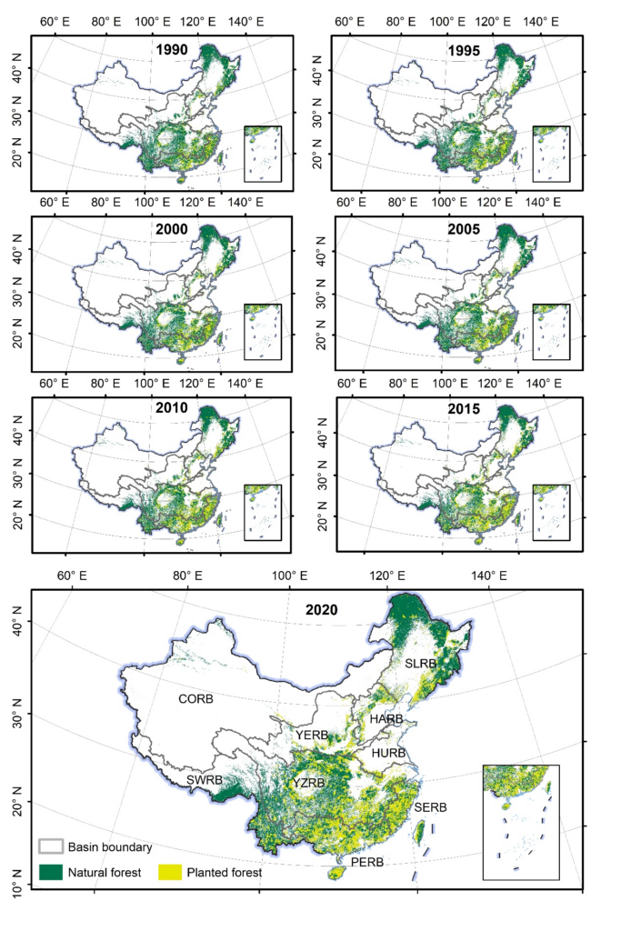
Tree planting has been suggested as a potentially effective solution for mitigating climate change. China has implemented the world’s largest afforestation and reforestation project since the 1970s, but high-resolution maps of China’s planted forests remain unavailable. In this study, we explored the use of multi-source remote sensing images and crowdsourced samples to produce the first high-resolution (30-m) map of China’s planted forests. We constructed a Google Earth Engine (GEE)-based mapping framework using spectral, temporal, structural, textural and topographic features derived from multi-source remote sensing data. Combined with over 600,000 field samples, we generated wall-to-wall planted forest maps at 30-m resolution for China every-five years from 1990 to 2020. Our maps were compared with planted forest map of National Forest Inventory and the reported National Forestry Statistical Yearbook, showing minor differences in the area and significantly positive relationships (R2 ranged from 0.8 to 0.9, P < 0.01). The overall accuracies for the generated quinquennial maps ranged from 77.3% to 81.8% from 1990 to 2020. Quinquennial maps of China’s planted forest from 1990 to 2020 reveal that the area of planted forests expanded at an annual rate of 14,613 km2, representing a 94.33% net increase from 464,715 km2 in 1990 to 903,099 km2 by 2020. This increase in planted forest area was the combined result of a gain of 479,681 km2 and a loss of 41,297 km2, leading to a net increase of 438,384 km2.