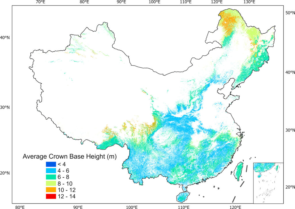
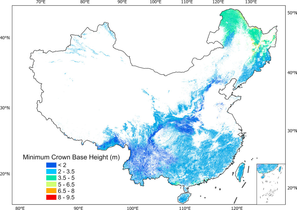
Crown base height (CBH) is essential for characterizing forest vertical structure over time for sustainable forest management and serves as a key input in fire model and growth model. At plot level, the average CBH (CBHa) is mainly used to assess tree growth and construct biomass models while the minimum CBH (CBHmin) can indicate the fire risk and fire behaviour. However, there are currently few CBH products available at a national or global scale. We developed a newly tree-based framework that uses machine learning and multiple source remote sensing data for generating CBH products across China. We collected over 1117 km2 close-range Lidar data and used the proposed method for estimating CBH. The CBH estimation results were converted to average value and minimum value in a 1 km × 1 km plot and served as training data to generate CBH maps across China at 1 km resolution. To our best knowledge, this is the first CBH map across China, and also the first national-scale average and minimum CBH maps around the world. The results showed that the average CBHa and CBHmin were 6.76 m and 2.70 m with standard deviations of 1.59 m and 0.85 m. The methods and maps would provide a new dimension in monitoring changes in forest structure, assessing fire risk and constructing biomass models in future studies.
Reference:
Yang Zekun#, Qi Zhiyong#, Chen Yuling, Cheng Kai, Yang Haitao, Chen Mengxi, Xu Jiachen, Zhang Yixuan, Ren Yu, Liu Weiyan, Lin Danyang, Huang Guoran, Xiang Tianyu, Xu Guangcai, Guo Qinghua*. 2025. Revealing the spatial distribution of crown base height across China based on close-range Lidar data. Remote Sensing of Environment. 331(2025): 115030.