Global forest ecosystems form a large carbon pool, and are a critical component of the global carbon cycle. Accurate estimations of global forest aboveground biomass (AGB) will improve understanding of global carbon dynamics and help quantify anthropogenic carbon emissions. Light detection and ranging (LiDAR) techniques have been proven to accurately capture both horizontal and vertical […]
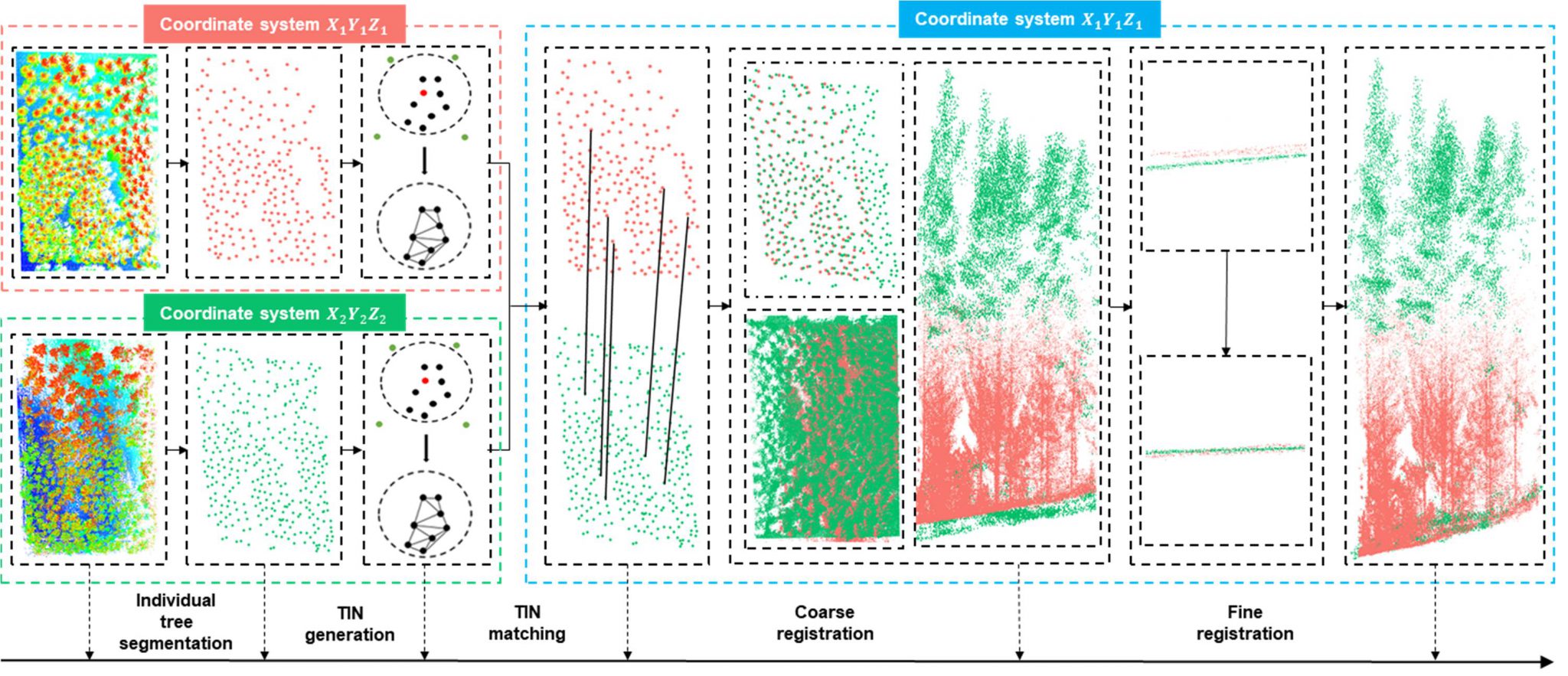
Automatic multi-view lidar registration tool
Light detection and ranging (lidar) can be used to accurately estimate forest structure attributes using the rich three-dimensional (3D) information within the lidar point clouds, and has been proven to be highly useful for forest inventory practices. Currently, airborne, unmanned aerial vehicle (UAV)-borne, mobile, and terrestrial lidar systems are the most commonly used lidar platforms […]
Automatic multi-view lidar registration tool-1
Light detection and ranging (lidar) can be used to accurately estimate forest structure attributes using the rich three-dimensional (3D) information within the lidar point clouds, and has been proven to be highly useful for forest inventory practices. Currently, airborne, unmanned aerial vehicle (UAV)-borne, mobile, and terrestrial lidar systems are the most commonly used lidar platforms […]
Benchmark dataset for airborne lidar scanning data filtering in forested environments-1
Data description: Airborne laser scanning (ALS) data is one of the most commonly used data for terrain products generation. Filtering ground points is a prerequisite step for ALS data processing. Because canopy cover and terrain slope are various in forested environments, filtering in forested environments is more challenging than filtering in other environments, such as […]
Global mangrove forest AGB map-1
Mangrove forest ecosystems are distributed at the land–sea interface in tropical and subtropical regions and play an important role in carbon cycles and biodiversity. Accurately mapping global mangrove aboveground biomass (AGB) will help us understand how mangrove ecosystems are affected by the impacts of climatic change and human activities. Light detection and ranging (LiDAR) techniques […]