
Woody residence time is an important parameter that expresses the balance between mature forest recruitment/growth and mortality. Using field data collected from the literature, our group explored the global forest τw and investigated its influence on model simulations of aboveground biomass (AGB) at a global scale. We estimated the global 1 km τw using a random forest […]
Global forest AGB map
Global forest ecosystems form a large carbon pool, and are a critical component of the global carbon cycle. Accurate estimations of global forest aboveground biomass (AGB) will improve understanding of global carbon dynamics and help quantify anthropogenic carbon emissions. Light detection and ranging (LiDAR) techniques have been proven to accurately capture both horizontal and vertical […]
ModEco
ModEco is a software package for ecological niche modeling. It integrates a range of niche models within a geographical information system. ModEco provides a user friendly platform that enables users to explore, analyze, and model species distribution data with relative ease. It contains a suite of functions such as data input/output, data visualization, feature analysis, […]
“Forest3D”: a python package for processing forest lidar data
Forest3D is a Python package for processing forest lidar data. It was developed by the digital ecosystem lab from institute of botany, Chinese academy of science. The purpose of Forest3D is providing a simple tool to deal with lidar data from different scanning platforms, e.g. airborne lidar scanners, terrestrial laser scanners and backpack lidar scanners. […]
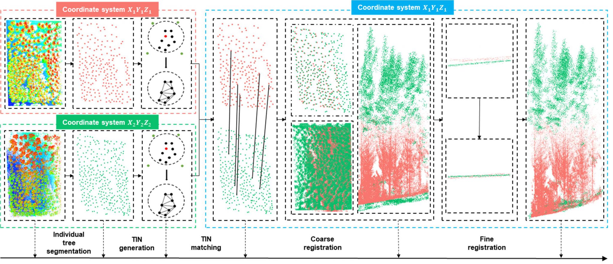
Automatic multi-view lidar registration tool
Light detection and ranging (lidar) can be used to accurately estimate forest structure attributes using the rich three-dimensional (3D) information within the lidar point clouds, and has been proven to be highly useful for forest inventory practices. Currently, airborne, unmanned aerial vehicle (UAV)-borne, mobile, and terrestrial lidar systems are the most commonly used lidar platforms […]
Python code examples and sample data of “LiDAR Principles, Processing and Applications in Forest Ecology”
LiDAR Principles, Processing and Applications in Forest Ecology (in Chinese) Light detection and ranging (LiDAR), as an emerging active remote sensing technology, provides a new three-dimensional (3D) view for ecology studies. It pushes ecology studies to transform from two-dimensional to 3D. This book introduces the principle of LiDAR technology and how to collect and process […]
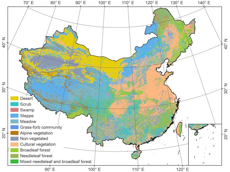
Mapping the new generation Vegetation Map of China
Vegetation maps provide crucial information for ecological studies, biodiversity conservation, vegetation management and restoration, and national strategic decision making. The current vegetation map of China was produced by a team of more than 250 scientists over the course of two decades starting in the 1980s, who spent a huge amount of efforts to manually delineate […]
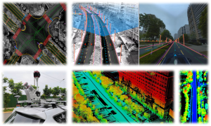
Intelligent Driving: Essential Tech Research & Development
Spatial Intelligence & Geo-Foundation Models Research Group Our research group focuses on the core domains of Spatial Intelligent Perception and Autonomous Navigation, driven by the frontier of Geospatial Intelligence (GeoAI). We integrate cutting-edge technologies including LiDAR SLAM, photogrammetry, and multi-source information fusion, with a strategic emphasis on Geospatial Foundation Models. To meet the operational requirements […]
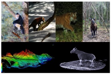
Animal 3D Ecology: Ecosystem Structure Reconstruction & Application
Knowledges about processing of interactions within organisms, between organisms and environment form bedrock of understanding how ecosystem organized. Interactions in forest ecosystem are inferred from patterns of spatial-temporal co-occurrence or avoidance in physical space. Based on the complexity of three-dimensional (3D) ecosystem, ecologists urgently need accurate in-situ data to construct nonlinear relationships and describe complex […]
Dr. Yumei Li was awarded the first-class funding of the 65th batch of the China Post-doctoral Science Fund
On April 26, 2019, the China Postdoctoral Science Foundation announced the list of obtainer of China’s Post-doctoral Science Fund of the 65th batch. Yumei Li, a post-doctor of the digital ecology group, was awarded first-class funding. This fully affirms her excellent scientific research ability and good innovation ability.