
Global forest ecosystems form a large carbon pool, and are a critical component of the global carbon cycle. Accurate estimations of global forest aboveground biomass (AGB) will improve understanding of global carbon dynamics and help quantify anthropogenic carbon emissions. Light detection and ranging (LiDAR) techniques have been proven to accurately capture both horizontal and vertical […]
Global forest woody residence time-1
Woody residence time is an important parameter that expresses the balance between mature forest recruitment/growth and mortality. Using field data collected from the literature, our group explored the global forest τw and investigated its influence on model simulations of aboveground biomass (AGB) at a global scale. We estimated the global 1 km τw using a random forest […]
Corrected SRTM DEM-1
SRTM (shuttle radar topography mission) DEM (digital elevation model) is a near-global terrain product with high accuracy, and has been widely used in many researches, such as hydrological survey, geological hazards assessment, and ecological protection. However, it has been proved that SRTM DEM is systematic higher than the real ground truth in vegetation regions, as […]
Python code examples and sample data of “LiDAR Principles, Processing and Applications in Forest Ecology”-1
LiDAR Principles, Processing and Applications in Forest Ecology (in Chinese) Light detection and ranging (LiDAR), as an emerging active remote sensing technology, provides a new three-dimensional (3D) view for ecology studies. It pushes ecology studies to transform from two-dimensional to 3D. This book introduces the principle of LiDAR technology and how to collect and process […]
“绿途”众源植被图片数据分析平台-APP端
“绿途”众源植被图片数据分析平台-APP端是由中国科学院植物研究所植被与环境变化国家重点实验室数字生态课题组研发完成,通过众源采集,用户标记,专家判读得到覆盖全国尺度的植被分布信息,旨在服务于1:50万新一代中国植被图制作。 “绿途” APP主要用于植被数据采集,用户登录后可根据不同植被类型规范拍照,并添加群系信息或描述,当照片记录GPS信息符合要求后即可将数据上传至平台。“绿途”APP实现了支持免注册登录、离线采集、兴趣点标记、1:100万植被图叠加、离线地图、专家打点、群系类型模糊匹配等功能。WEB端是与APP端对应的专家审核系统,专家根据植被知识和野外经验对选区数据进行审核。审核内容主要是根据用户上传的三张照片,参考用户描述信息,确定植被类型。WEB端实现了历史数据上传、自定义斑块上传以及数据查询和下载等功能。该平台已经在山东、京津冀、广西和内蒙古等地区进行测试使用,并向全国29个省市自治区的植被专家和学者开展了推广和培训。该平台持续使用将源源不断地积累植被样点数据,为未来全国和区域尺度植被图更新提供了重要的数据和技术储备。 欢迎大家下载使用!
Shichao Jin, student of Digital Ecosystem Group attended the 2019 International Student Research Forum
Shichao Jin, a PhD candidate of Digital Ecosystem Group, was selected and invited as one of the 10 excellent student representatives of University of Chinese Academy of Sciences (UCAS) to attend the 2019 International Student Research Forum. The Forum was hosted by South Denmark University on June 16th to June 20th. Students from China, United […]
ModEco-1
ModEco is a software package for ecological niche modeling. It integrates a range of niche models within a geographical information system. ModEco provides a user friendly platform that enables users to explore, analyze, and model species distribution data with relative ease. It contains a suite of functions such as data input/output, data visualization, feature analysis, […]
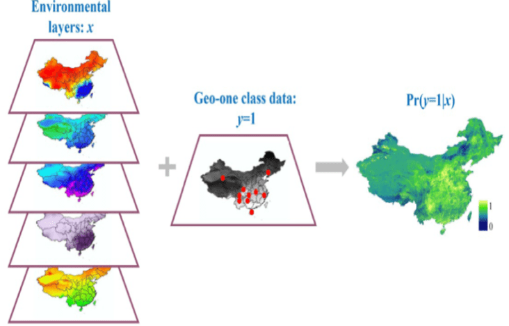
Geographic One-class Data: Methods & Applications
Geographic One-class Data: Methods & Applications We are interested in the theory and applications of geographic one-class data. One common problem with geographic data is that, for a specific geographic event, only occurrence information is available; information about the absence of the event is not available. We define these specific types of geospatial data as […]
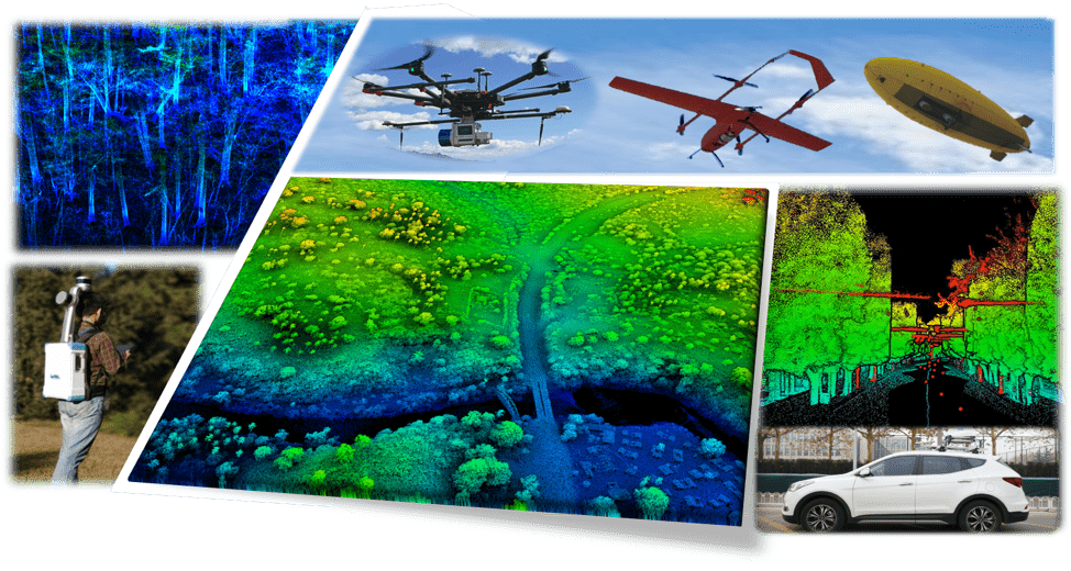
Development of near-surface remote sensing platforms
Development of Near-surface Remote Sensing Platforms for Forest Resource Information Acquisition Light detection and ranging (lidar), an active remote sensing technology, has the abilities of high-precision and strong penetration to vegetation, which shows unparalleled advantages in obtaining forest resource information comparing with other traditional remote sensing technologies. In this context, we designed and developed a […]
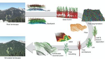
3D Forest Structure: Parameter Extraction & Upscaling
3D forest structure parameter extraction and upscaling Individual trees are the basic element composition of a forest stand. The structure characteristic and spatial distribution of trees are the key factors to be surveyed in forest inventory. Lidar, as an emerging active remote sensing technology, provides an automatic, effective and accurate tool for deriving individual tree […]