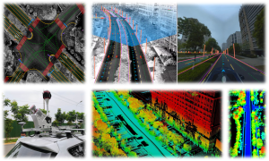
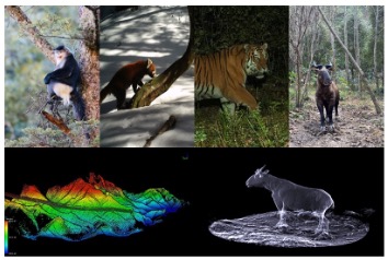
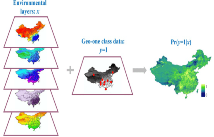
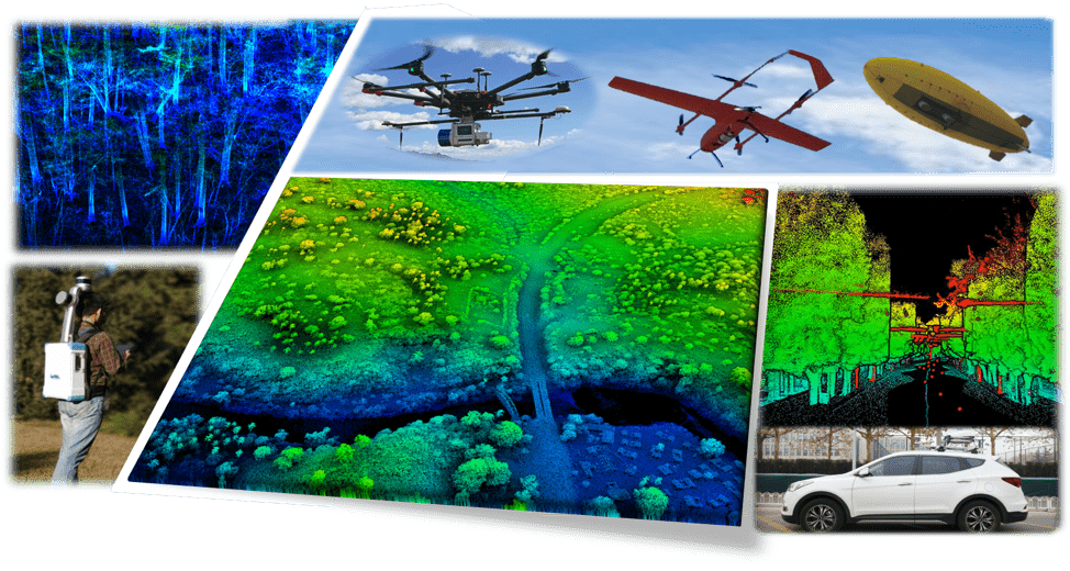
Posted on Category: Projects Spatial Intelligence & Geo-Foundation Models Research Group

Spatial Intelligence & Geo-Foundation Models Research Group

Spatial Intelligence & Geo-Foundation Models Research Group Our research group focuses on the core domains of Spatial Intelligent Perception and Autonomous Navigation, driven by the frontier of Geospatial Intelligence (GeoAI). We integrate cutting-edge technologies including LiDAR SLAM, photogrammetry, and multi-source information fusion, with a strategic emphasis on Geospatial Foundation Models. To meet the operational requirements […]

Comments Off on Spatial Intelligence & Geo-Foundation Models Research GroupCategory: Projects
Posted on Category: Projects Environmental Change and Terrestrial Ecosystem Response

Environmental Change and Terrestrial Ecosystem Response

Environmental Change and Terrestrial Ecosystem Response Changes of forest quality are composed by the changes in forest structure and species composition, which are usually caused by tree growth, anthropogenic activities (e.g., forest treatment, logging), and environmental disturbances (e.g., drought, flood, and wildfire). To quantitatively assess forest structure changes from multitemporal lidar data, we proposed an […]

Comments Off on Environmental Change and Terrestrial Ecosystem ResponseCategory: Projects
Posted on Category: Projects Mapping the new generation Vegetation Map of China

Mapping the new generation Vegetation Map of China

Vegetation maps provide crucial information for ecological studies, biodiversity conservation, vegetation management and restoration, and national strategic decision making. The current vegetation map of China was produced by a team of more than 250 scientists over the course of two decades starting in the 1980s, who spent a huge amount of efforts to manually delineate […]

Comments Off on Mapping the new generation Vegetation Map of ChinaCategory: Projects
Posted on Category: Projects Intelligent Driving: Essential Tech Research & Development

Intelligent Driving: Essential Tech Research & Development

Spatial Intelligence & Geo-Foundation Models Research Group Our research group focuses on the core domains of Spatial Intelligent Perception and Autonomous Navigation, driven by the frontier of Geospatial Intelligence (GeoAI). We integrate cutting-edge technologies including LiDAR SLAM, photogrammetry, and multi-source information fusion, with a strategic emphasis on Geospatial Foundation Models. To meet the operational requirements […]

Comments Off on Intelligent Driving: Essential Tech Research & DevelopmentCategory: Projects
Posted on Category: Projects Animal 3D Ecology: Ecosystem Structure Reconstruction & Application

Animal 3D Ecology: Ecosystem Structure Reconstruction & Application

Knowledges about processing of interactions within organisms, between organisms and environment form bedrock of understanding how ecosystem organized. Interactions in forest ecosystem are inferred from patterns of spatial-temporal co-occurrence or avoidance in physical space. Based on the complexity of three-dimensional (3D) ecosystem, ecologists urgently need accurate in-situ data to construct nonlinear relationships and describe complex […]

Comments Off on Animal 3D Ecology: Ecosystem Structure Reconstruction & ApplicationCategory: Projects
Posted on Category: Projects Geographic One-class Data: Methods & Applications

Geographic One-class Data: Methods & Applications

Geographic One-class Data: Methods & Applications We are interested in the theory and applications of geographic one-class data. One common problem with geographic data is that, for a specific geographic event, only occurrence information is available; information about the absence of the event is not available. We define these specific types of geospatial data as […]

Comments Off on Geographic One-class Data: Methods & ApplicationsCategory: Projects
Posted on Category: Projects Development of near-surface remote sensing platforms

Development of near-surface remote sensing platforms

Development of Near-surface Remote Sensing Platforms for Forest Resource Information Acquisition Light detection and ranging (lidar), an active remote sensing technology, has the abilities of high-precision and strong penetration to vegetation, which shows unparalleled advantages in obtaining forest resource information comparing with other traditional remote sensing technologies. In this context, we designed and developed a […]

Comments Off on Development of near-surface remote sensing platformsCategory: Projects
Posted on Category: Projects 3D Forest Structure: Parameter Extraction & Upscaling

3D Forest Structure: Parameter Extraction & Upscaling

3D forest structure parameter extraction and upscaling Individual trees are the basic element composition of a forest stand. The structure characteristic and spatial distribution of trees are the key factors to be surveyed in forest inventory. Lidar, as an emerging active remote sensing technology, provides an automatic, effective and accurate tool for deriving individual tree […]

Comments Off on 3D Forest Structure: Parameter Extraction & UpscalingCategory: Projects
Posted on Category: Projects Spatial & Temporal Monitoring: Forest Resource Analysis

Spatial & Temporal Monitoring: Forest Resource Analysis

Monitoring and analyzing the spatial and temporal changes of forest resource information Changes of forest quality are composed by the changes in forest structure and species composition, which are usually caused by tree growth, anthropogenic activities (e.g., forest treatment, logging), and environmental disturbances (e.g., drought, flood, and wildfire). To quantitatively assess forest structure changes from […]

Comments Off on Spatial & Temporal Monitoring: Forest Resource AnalysisCategory: Projects

Mapping the new generation Vegetation Map of China-1

Vegetation maps provide crucial information for ecological studies, biodiversity conservation, vegetation management and restoration, and national strategic decision making. The current vegetation map of China was produced by a team of more than 250 scientists over the course of two decades starting in the 1980s, who spent a huge amount of efforts to manually delineate […]